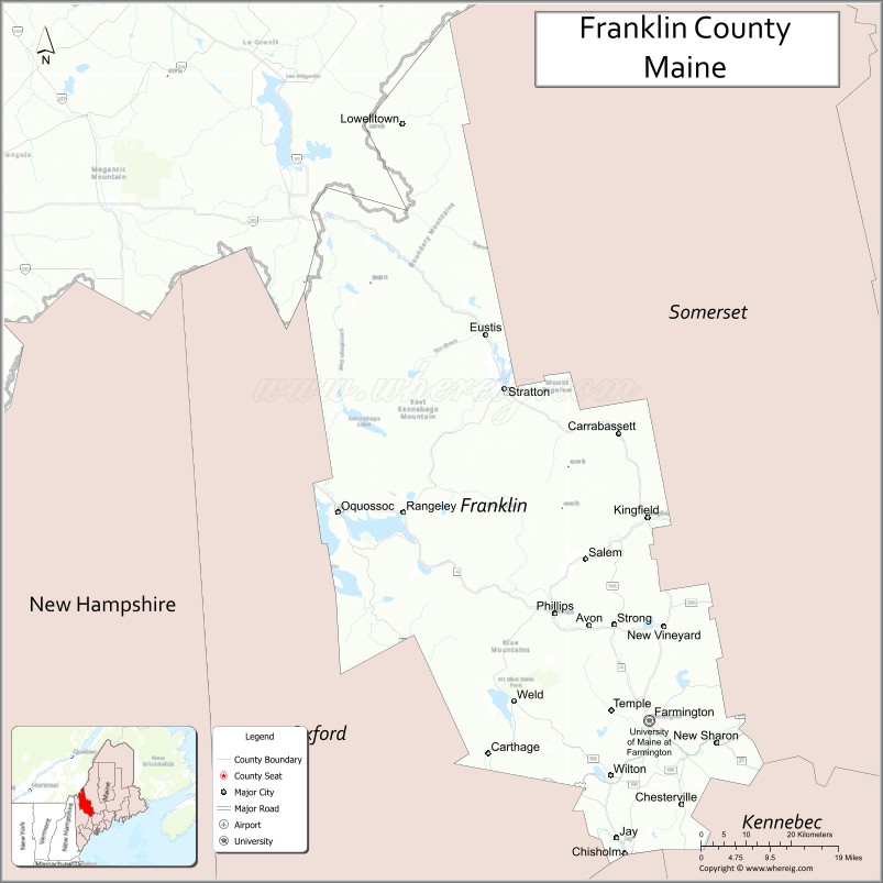
 Franklin County, a county nestled into the Western region of Maine, reaches from the Canadian border at Coburn Gore to the foothills of Jay alongside the Androscoggin River, with approximately 30,000 residents and 1,743 square miles of land. The county was established on May 9, 1838, and named for Benjamin Franklin.
Currently the county consists of the following: towns of Avon, Carrabassett Valley, Carthage, Chesterville, Eustis, Farmington, Industry, Jay, Kingfield, New Sharon, New Vineyard, Phillips, Rangeley, Strong, Temple, Weld, and Wilton; plantations of Coplin, Rangeley, and Sandy River; Salem Township, and several other unorganized townships.
2023 Point-in-Time-Data
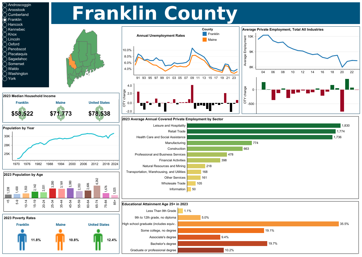
Population: 30,145
Number of Households: 12,457
Median Household Income: $58,522 (state average: $73,733)
ALICE Households: 35% (state average 29%)
Households in Poverty: 12% (state average 11%)
Our Programs
- Don't Despair Car Repair (click here for more info)
- Packs for Progress (Backpacks are available through many schools in the Franklin County area)
- Hope Fund (Click here for more info)
- 211Maine
Get connected to resources in your area. It's free, easy & confidential
Dial 2 1 1 or online at www.211maine.org